File:Skyline of Sumy (cropped).jpg
Jump to navigation
Jump to search


Size of this preview: 1,280 × 803 pixels. Other resolutions: 320 × 201 pixels | 640 × 402 pixels | 800 × 502 pixels | 1,024 × 642 pixels | 2,786 × 1,748 pixels.
Original file (2,786 × 1,748 pixels, file size: 4.93 MB, MIME type: image/jpeg)
| This is a file from the Wikimedia Commons. The description on its description page there is shown below.
|
Summary
| Description |
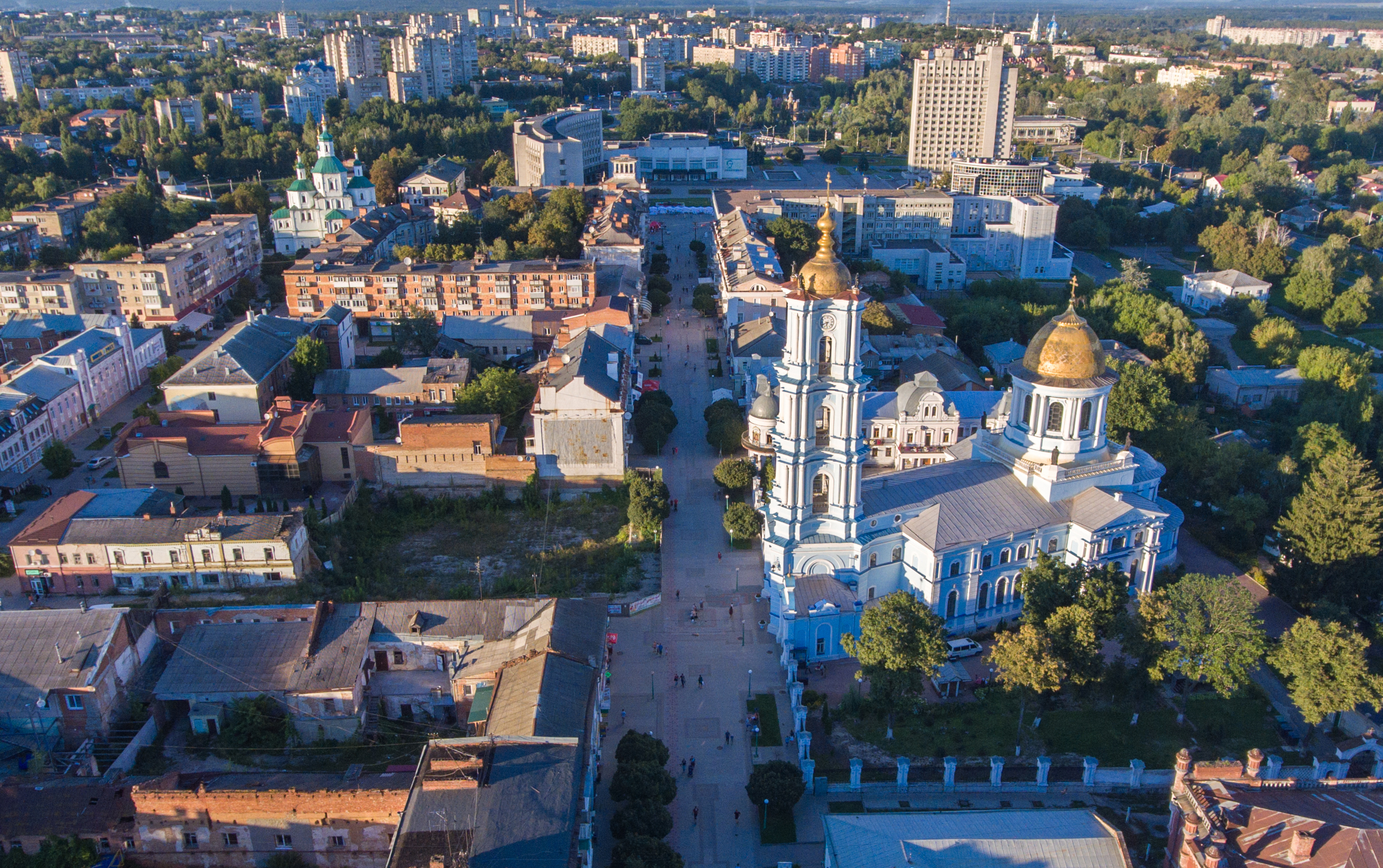
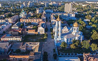
Українська: Спасо-Преображенський собор (мур.), Суми, вул. Соборна, 31
English: Transfiguration Cathedral in Sumy, Ukraine.
|
||
| Date | |||
| Source | Own work | ||
| Author | Максим Бондаревский | ||
| Other versions |


.jpg)
| Camera location | | View this and other nearby images on: OpenStreetMap |
|---|
.jpg¶ms=050.909162_N_0034.800693_E_globe:Earth_type:camera__&language=en)
Licensing
I, the copyright holder of this work, hereby publish it under the following license:
This file is licensed under the Creative Commons Attribution-Share Alike 4.0 International license.
- You are free:
- to share – to copy, distribute and transmit the work
- to remix – to adapt the work
- Under the following conditions:
- attribution – You must give appropriate credit, provide a link to the license, and indicate if changes were made. You may do so in any reasonable manner, but not in any way that suggests the licensor endorses you or your use.
- share alike – If you remix, transform, or build upon the material, you must distribute your contributions under the same or compatible license as the original.

|
This image was uploaded as part of Wiki Loves Monuments 2016.
|
 |
File history
Click on a date/time to view the file as it appeared at that time.
| Date/Time | Thumbnail | Dimensions | User | Comment | |
|---|---|---|---|---|---|
| current | 10:57, 9 March 2022 | | 2,786 × 1,748 (4.93 MB) | wikimediacommons>Andrew J.Kurbiko | File:Skyline of Sumy.jpg cropped 16 % vertically using CropTool with precise mode. |
File usage
There are no pages that use this file.
.jpg)