File:Delineatio generalis Camporum Desertorum vulgo Ukraina (1648).jpg
Jump to navigation
Jump to search

Size of this preview: 1,280 × 1,006 pixels. Other resolutions: 305 × 240 pixels | 611 × 480 pixels | 763 × 600 pixels | 977 × 768 pixels | 2,560 × 2,012 pixels | 2,992 × 2,352 pixels.
Original file (2,992 × 2,352 pixels, file size: 1.94 MB, MIME type: image/jpeg)
| This is a file from the Wikimedia Commons. The description on its description page there is shown below.
|
.jpg)
Summary
| Description |
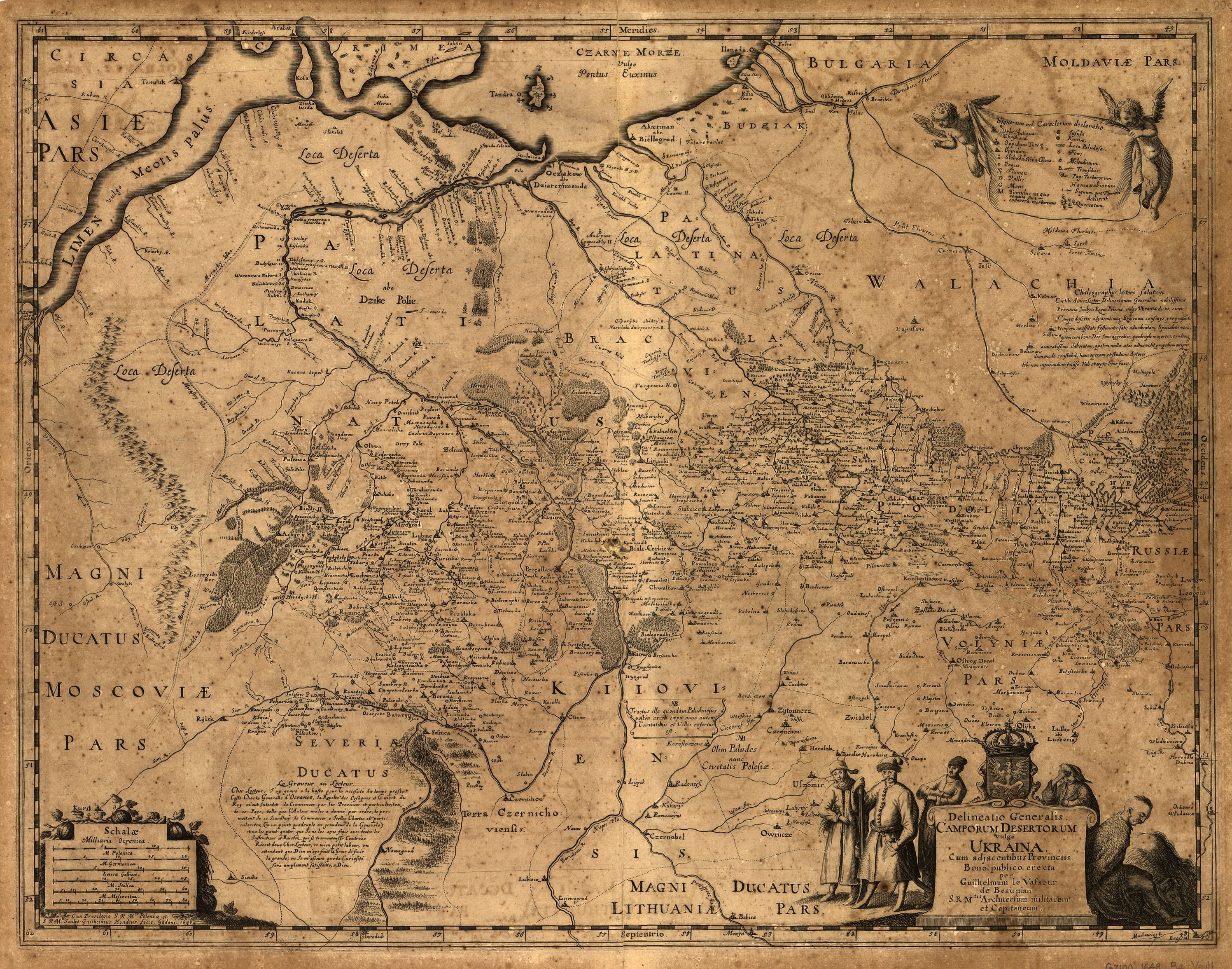
English: A 1648 map of Ukraine created by Guillaume le Vasseur de Beauplan and published by Villem Gondius. |
|||||||||||||||||||
| Date | ||||||||||||||||||||
| Source | http://byloe.blogspot.com/2011/04/blog-post_24.html | |||||||||||||||||||
| Author |
|
|||||||||||||||||||
Licensing
|
This work is in the public domain in its country of origin and other countries and areas where the copyright term is the author's life plus 100 years or fewer. This work is in the public domain in the United States because it was published (or registered with the U.S. Copyright Office) before January 1, 1929. | |
| This file has been identified as being free of known restrictions under copyright law, including all related and neighboring rights. | |
File history
Click on a date/time to view the file as it appeared at that time.
| Date/Time | Thumbnail | Dimensions | User | Comment | |
|---|---|---|---|---|---|
| current | 03:15, 28 August 2013 | | 2,992 × 2,352 (1.94 MB) | wikimediacommons>Rotatebot | Bot: Image rotated by 180° |
File usage
There are no pages that use this file.
.jpg)