File:High Bridge Glory Hole, Lincoln.jpg
Jump to navigation
Jump to search


Size of this preview: 1,280 × 986 pixels. Other resolutions: 312 × 240 pixels | 623 × 480 pixels | 779 × 600 pixels | 997 × 768 pixels | 2,560 × 1,973 pixels | 2,990 × 2,304 pixels.
Original file (2,990 × 2,304 pixels, file size: 3.37 MB, MIME type: image/jpeg)
| This is a file from the Wikimedia Commons. The description on its description page there is shown below.
|
Summary
| Description |
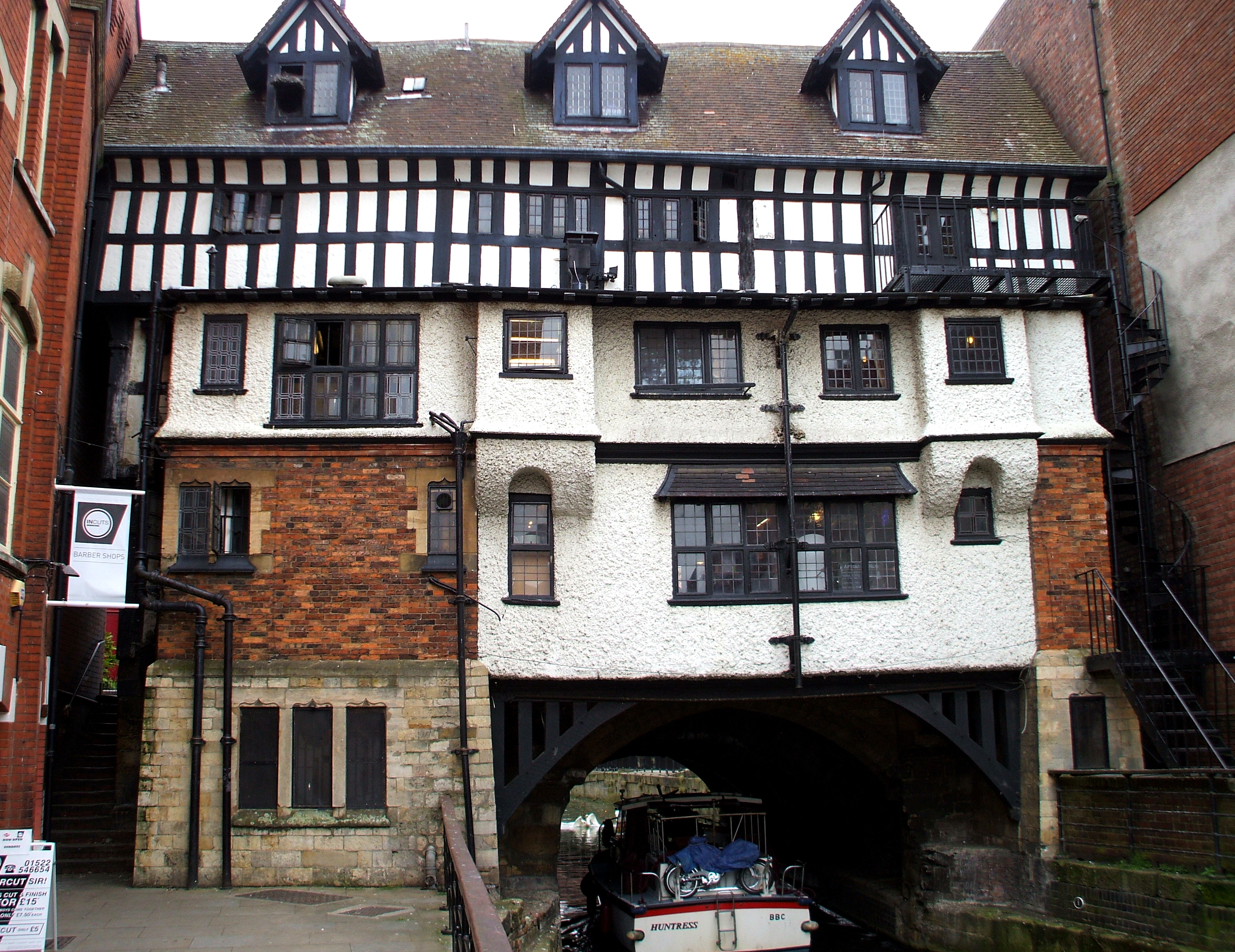
English: The High Bridge in Lincoln, England, is the oldest bridge in the United Kingdom which still has buildings on it. The arch is known locally as 'The Glory Hole'. |
| Date | |
| Source | I Marek Kosniowski (Marek.69) created this work entirely by myself. Own work |
| Author | Marek69 |
| Camera location | | View this and other nearby images on: OpenStreetMap |
|---|
Licensing
I, the copyright holder of this work, hereby publish it under the following licenses:

|
Permission is granted to copy, distribute and/or modify this document under the terms of the GNU Free Documentation License, Version 1.2 or any later version published by the Free Software Foundation; with no Invariant Sections, no Front-Cover Texts, and no Back-Cover Texts. A copy of the license is included in the section entitled GNU Free Documentation License. |
This file is licensed under the Creative Commons Attribution-Share Alike 4.0 International, 3.0 Unported, 2.5 Generic, 2.0 Generic and 1.0 Generic license.
- You are free:
- to share – to copy, distribute and transmit the work
- to remix – to adapt the work
- Under the following conditions:
- attribution – You must give appropriate credit, provide a link to the license, and indicate if changes were made. You may do so in any reasonable manner, but not in any way that suggests the licensor endorses you or your use.
- share alike – If you remix, transform, or build upon the material, you must distribute your contributions under the same or compatible license as the original.
You may select the license of your choice.
File history
Click on a date/time to view the file as it appeared at that time.
| Date/Time | Thumbnail | Dimensions | User | Comment | |
|---|---|---|---|---|---|
| current | 01:00, 12 June 2013 | | 2,990 × 2,304 (3.37 MB) | wikimediacommons>Marek69 | User created page with UploadWizard |
File usage
There are no pages that use this file.